

According to the New York State Canal Corporation, nearly 80% of the upstate New York population lives within 25 miles of the Erie Canal. The original Erie Canal, nicknamed “Clinton’s Ditch” by its critics, was completed in 1825. It was later expanded to accommodate larger boats, leading to the creation of the Enlarged Erie Canal. Further modifications completed in 1918 created the Barge Canal, allowing self-propelled vessels to replace boats towed by mules. Today, the waterway is commonly known as the Erie Canal. The larger New York State Canal System includes the connecting Cayuga-Seneca, Oswego, and Champlain Canals.
Visiting Old Erie Canal Lock 62 behind Pittsford Plaza provides a glimpse into the canal’s early days. You may wonder where locks 61 and 63 were located. Lock 66 lies in a neighborhood bounded by Monroe Avenue, Goodman Street, and I-490, making it possible to trace portions of the canal’s former route through Rochester. Imagine Monroe Avenue, I-490 through the Swillburg neighborhood, and Broad Street filled with water.
To explore the Erie Canal, visit villages like Brockport or Fairport and spend a few hours dining and shopping in these historic canal towns. New York State Route 31 parallels much of the canal between Lyons and Lockport, making it easy to explore several canal communities in a single day. Greece Canal Park, Great Embankment Park, and Meridian Centre offer opportunities to walk or bike along the Erie Canalway Trail. You can also get on the water in a kayak or take a boat tour. Or pack a picnic and visit one of the massive canal locks to watch boats pass through. Lock and lift bridge operators are often willing to answer questions about canal operations and local history. If you catch them when they are not operating the locks, they may even offer you a tour or show you places you can explore on your own. Explore the canal communities listed below from east to west, beginning in Clyde and ending at the Niagara River.
Clyde

Clyde, Wayne County, has a small number of restaurants, shops, and services around its historic square, as well as the Galen Historical Society Museum. Clyde Canal Park provides access to the Erie Canalway Trail and public docks for boaters. Lock E-26 is roughly three miles southeast of the village.

Lyons

Lyons, Wayne County seat, is a historic canal town where the 1915 Ohmann Theatre and 1943 Dobbins Drugs are still owned and operated by descendants of the founding families. Explore Water, Broad, Church, and William Streets to discover local shops, including The Christmas Store of New York and The Mercantile @ Newberry. The Museum of Wayne County History, housed in the former Wayne County jail on Butternut Street, is also worth a visit. The Canandaigua Outlet joins the canal beside Lock E-27. At Lock E-28A, one of only two remaining dry docks on the canal system, boats and barges are floated in for repairs. When the dock is drained, vessels such as the Colonial Belle are left high and dry.
Newark

Newark, Wayne County, features a canalside park with vibrant, heritage-inspired murals and a visitor information center within walking distance of shops and ice cream. Head east along the canal to Lock E-28B and the Lockville Trail, where you can explore the historic Old Enlarged Erie Locks 58 and 59.
Fun fact: As you follow New York State Route 31 west from Newark toward Palmyra, you enter Ontario County at Port Gibson and return to Wayne County about one mile later. Port Gibson is Ontario County’s only community on the Erie Canal.
Palmyra

Palmyra, Wayne County, is home to five museums—the Palmyra Historical Museum, Erie Canal Depot, Print Shop Museum, Phelps General Store and Residence, and the Alling Coverlet Museum—that explore the community’s rich history. Discover local shops along the way and head to the intersection of Church and Main to see the historic four-corner churches. At Pal-Mac Aqueduct County Park, explore Lock E-29, the remains of the 1857 Palmyra Aqueduct, and the Aldrich Change Bridge, where Ganargua Creek passes beneath the canal.
Macedon

Macedon, Wayne County, is one of the few places where you can see the convergence of all three historic canals—the original Clinton’s Ditch, the Enlarged Erie Canal, and the present-day Barge Canal. From Macedon Canal Park, follow the Butterfly Trail to the convergence point. Lock E-30 is beside the parking area.
Fun fact: There is no Lock E-31. It was planned but never built because it was deemed unnecessary, and the remaining locks retained their original numbering.
Fairport

Fairport, Monroe County, is a vibrant canal village with a walkable Main Street lined with restaurants, cafés, and shops. Learn about historic and modern canal life aboard the three-hour Colonial Belle lock cruise, or rent a standard or adaptive kayak or bicycle from Erie Canal Boat Company to explore independently. The village hosts Fairport Canal Days in June and the Fairport Music Festival in August.
Bushnell’s Basin
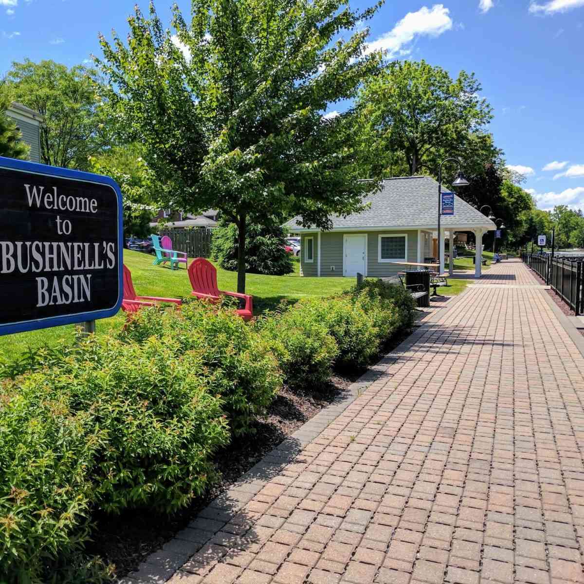
Bushnell’s Basin, Monroe County, is a popular stop along the Erie Canal, known for its canalside restaurants, breweries, and ice cream shops. Access to the Erie Canalway Trail and public kayak launches also makes it a favorite with walkers, cyclists, and paddlers.
Pittsford

Pittsford, Monroe County, is the county’s oldest canal town. Schoen Place, in the heart of the village, is lined with restaurants, shops, and historic canal buildings. Take a 90-minute narrated cruise aboard the Sam Patch packet boat through Lock E-32, or, for a more adventurous experience, paddle the Class 2-3 spillway rapids at Lock 32 Whitewater Park.
Brighton

Brighton, Monroe County, offers two notable access points to the Erie Canal. The canal park at Lock E-33 is a good place to watch boats pass through the lock. Meridian Centre Park features trails through grasslands behind the Jewish Home of Rochester that connect to the Erie Canalway Trail.
Rochester, delivered
A weekly Substack newsletter, with periodic essays exploring behind-the-scenes work and reflections on traveling close to home. While the content is free, paid subscriptions support my ongoing research and writing.
Rochester
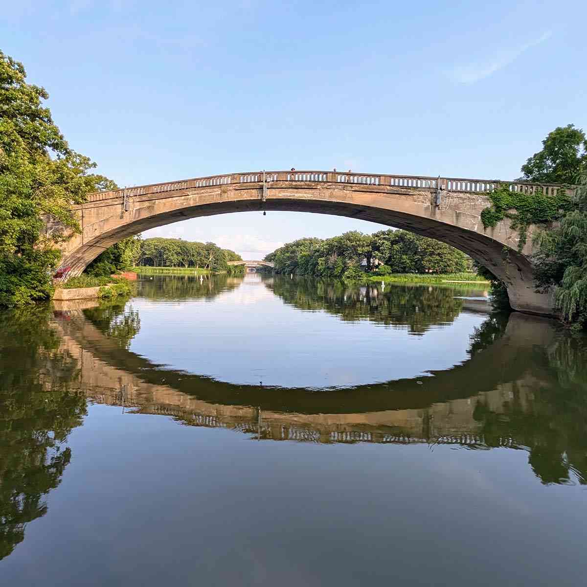
Rochester, Monroe County seat, earned the nicknames “Young Lion of the West” for its rapid growth and “The Flour City” for the flour mills that lined the Genesee River. The second Genesee Aqueduct, completed in 1842, now forms the foundation of Broad Street Bridge over the Genesee River. In 1918, the Erie Canal was rerouted along the city’s southern border through Genesee Valley Park.
Greece

Greece, Monroe County, offers access to the Erie Canal at Greece Canal Park and Henpeck Park. About one mile east of Henpeck Park, the historic Junction Lock marks the temporary connection between the Enlarged Erie Canal and the new Barge Canal during construction of Rochester’s canal bypass.
Spencerport

Spencerport, Monroe County, is a welcoming canal village with cafés, shops, and restaurants along Union Street. The Spencerport Depot and Canal Museum explores the region’s transportation and canal heritage while serving as the village’s visitor center and providing amenities for overnight boaters.
Adams Basin


Adams Basin, Monroe County, is a quiet canal hamlet centered on the historic Adams-Ryan House, a rare surviving Erie Canal inn and tavern built in 1825 and now a private residence. It later served as a railroad ticket office and bed-and-breakfast. The historic Washington Street lift bridge, canal, and towpath make Adams Basin a quiet place for a picnic.
Brockport

Brockport, Monroe County, is distinguished by two lift bridges—Main Street and Park Avenue—operated by a single bridge tender who walks between them. The Canalfront Welcome Center offers overnight camping and other amenities for hikers, cyclists, and boaters during the canal navigation season. Main Street offers a variety of shops and restaurants, including Lift Bridge Book Shop and the historic Strand Theatre, which has operated as a movie theater since 1916.
Holley

Holley, Orleans County, is home to Holley Canal Falls, which can be viewed from the parking area. Created by overflow from the Erie Canal, the waterfall descends into the glen before joining Sandy Creek. Picnic areas, fishing access, and trails invite visitors to spend more time exploring the park.
Albion

Albion, Orleans County seat, features an impressive downtown with the domed courthouse and numerous Medina sandstone buildings, including the Pullman Memorial Universalist Church, built by George Pullman and featuring Tiffany stained-glass windows. The village also honors its connection to Charles W. Howard, founder of the world’s first Santa Claus School, with a downtown mural and bronze statue. Perched atop a glacial drumlin, the Soldiers and Sailors Monument at Mount Albion Cemetery offers panoramic views of the surrounding countryside from the top of its 68-foot tower.
Medina

Medina, Orleans County, is home to the only road that passes beneath the Erie Canal. The Medina Railroad Museum features an extensive HO-scale model train layout and excursion trains during special events. Downtown, admire the village’s many sandstone buildings and visit the Medina Sandstone Hall of Fame to learn about the stone’s history and legacy. End your visit at Medina Falls, where Oak Orchard Creek flows under the canal.
Lockport

Lockport, Niagara County seat, is defined by the Erie Canal’s climb over the Niagara Escarpment. Explore modern Locks E-34 and E-35 alongside the restored Flight of Five Locks, then experience the canal firsthand aboard a Lockport Locks and Erie Canal Cruise. Restaurants, cafés, breweries, and the Erie Canal Discovery Center are all within walking distance.
North Tonawanda and Tonawanda
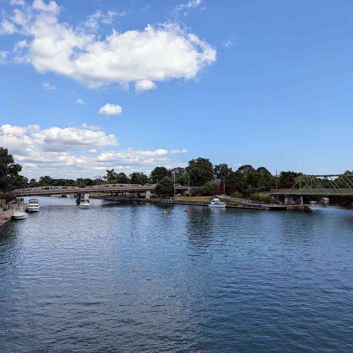
North Tonawanda, Niagara County, and Tonawanda, Erie County, mark the western end of the New York State Canal System, where Tonawanda Creek meets the Niagara River. Connected by several bridges, including the pedestrian-friendly Renaissance Bridge, the two cities share Gateway Harbor, riverfront parks, and walking paths along the canal and Niagara River. Attractions include the Herschell Carrousel Factory Museum, the Riviera Theatre, and Platter’s Chocolate Factory, known for its signature orange chocolate. Canal Fest of the Tonawandas takes place each July.
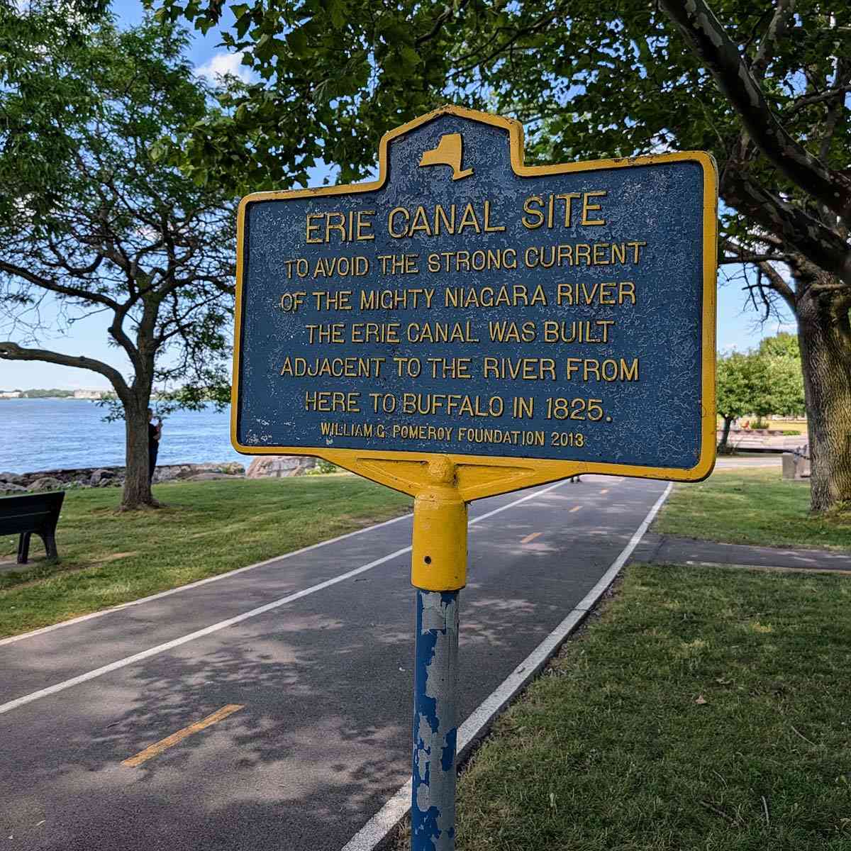
Where did the original canal go after leaving Tonawanda Creek, and where was its western terminus? Today’s Erie Canal ends where Tonawanda Creek meets the Niagara River, as modern vessels can navigate the mighty Niagara. The original section of the canal, which ended where the Buffalo River meets Lake Erie, was abandoned in 1918 when the state rerouted the canal to accommodate larger vessels. Look for evidence of its path along the Erie Canalway Trail Riverwalk on I-90 to Black Rock Canal Park, where the canal once closely followed the Niagara River.
Additional Erie Canal Resources

The eriecanalway.org website is an excellent resource for learning more about the canal and how locks work. The Erie Canal Learning Hub provides free curriculum resources, field trips, virtual 3D tours, and other online tools for teachers and students learning about the canal. They also maintain a calendar of events along the canal throughout the year.
Cycle the Erie provides information and recommendations for those cycling along the canal.
You can pass through any lock in a kayak for free, no permit needed. Learn more about paddling on the New York State Canal Corporation’s website.
Depending on your timeline, you can rent a houseboat from Mid-Lakes Navigation in Macedon and dock overnight at ports in Wayne, Seneca, and Monroe counties.
Join the Historic Erie Canal Facebook group to discuss everything about the Erie Canal. It’s a great platform to connect with fellow canal enthusiasts, share information, stories, news, and photos, and join grassroots efforts that shape the canal’s future.
List of Locks


Out of the 35 locks on the Erie Canal, 11 are located between the Cayuga-Seneca Canal and the Niagara River. Interestingly, Lock 31 was never built, even though it was initially planned. It was deemed unnecessary, never constructed, and the locks were not renumbered.
Listed from East to West:
- Lock 25 – Seneca Falls
- Lock 26 – Clyde
- Lock 27 – Lyons
- Lock 28A – Lyons
- Lock 28B – Newark
- Lock 29 – Palmyra
- Lock 30 – Macedon
- Lock 32 – Pittsford
- Lock 33 – Brighton-Henrietta
- Lock 34 – Lockport
- Lock 35 – Lockport
List of Lift Bridges


All 16 lift bridges along the Erie Canal are between Fairport and Lockport. Fairport’s 1914 lift bridge is the only bridge in the world built on a bias. The south end is higher than the north end. It is built so that no two angles in the bridge are the same, and no corners on the bridge floor are square.
Listed from East to West:
- Fairport, Main Street
- Spencerport, Union Street
- Adams Basin, Washington Street
- Brockport, Park Avenue
- Brockport, Main Street
- Holley, East Avenue
- Hulberton, Hulberton Road
- Albion, Ingersoll Street
- Albion, Main Street
- Albion, Gaines Basin Road
- Albion, Eagle Harbor Waterway Road
- Knowlesville, Knowlesville Road
- Medina, Prospect Avenue
- Middleport, Main Street
- Gasport, Hartland Road
- Lockport, Mill Street
Note that Lockport’s Adam Street is permanently open.
Google Map of Locations
A Brief History of the Canal
[from the New York State Canal Corporation]

Built between 1817 and 1825, the original Erie Canal spanned 363 miles from the Hudson River at Albany to Lake Erie at Buffalo. By providing a waterway route connecting the Great Lakes to the Atlantic Ocean at New York City, the Erie Canal had immediate and lasting impacts on New York State and the nation.
The Erie Canal was the longest human-made waterway and, at the time, the most significant public works project in North America. People widely celebrated it as an engineering marvel and technological achievement.
The canal lowered freight costs, shortened travel times across New York, and spurred industries and cities along its path.
It transformed New York City into the nation’s principal seaport, creating a new gateway to the Midwest and Great Lakes.
The canal powered New York’s rise as the Empire State’s leader in population, industry, and economic strength.
The canal served as the Internet of its day, spreading news and promoting social movements like women’s rights and the abolition of slavery.
The canal was not favorable for everyone. Canal construction and the influx of people to the state contributed to the dispossession and displacement of Indigenous Peoples from their lands in New York and the Midwest. While building the canal provided jobs, the exploitation of immigrant labor and poor working conditions were documented during the initial canal construction and its later expansion.
The construction of the Erie Canal helped shape an American national identity that includes much of what we now consider fundamentally American: charismatic leadership, boldness and risk-taking, territorial expansionism, technological prowess, economic and industrial power, and cultural exchange.
The Changing Erie Canal
Since its opening in 1825, New York State has widened and deepened the Erie Canal three times to accommodate larger boats and more traffic. Each time, the route and structures, like locks and bridges, changed.
1825
The canal that opened in 1825 is often called the “old” or “original” Erie Canal. This canal was four feet deep and 40 feet wide.
1862 – 1918
From 1835 to 1862, the canal was enlarged to seven feet deep and 70 feet wide. Building new structures and deepening the canal took many years. From 1862 to the early 1900s, the canal was called the Enlarged Erie Canal.
1918 – Today
From 1905 to 1918, the canal was completely rebuilt to accommodate motorized boats and large commercial shipments. Since mules were no longer needed to pull boats, engineers moved some canal sections into rivers and lakes. The Erie Canal and the Champlain, Oswego, and Cayuga-Seneca canals were renamed the New York State Barge Canal System. The word “barge” is no longer commonly used since most canal traffic today is recreational.
The Canal Today
The New York State Canal System has operated continuously since 1825, longer than any other constructed transportation system on the North American continent. You can still travel by boat from Buffalo to Albany, or walk or cycle much of the former towpath, now part of the cross-state, multi-use Empire State Trail. Stretching from one end of New York State to the other, today’s Erie Canal is 338 miles long with 35 locks for 571 feet of elevation change. Numerous canal sites and museums showcase the canal’s legacy—from its locks and low bridges to its role in transforming New York State and its continued influence on communities along its shores. The NYS Canal System was designated a National Historic Landmark in 2016.

Where are your favorite spots along the Erie Canal?
I’d love to hear from you—please reach out and share your thoughts and experiences.


Help Support My Work
If my work has helped you explore and appreciate the Rochester area, please consider subscribing to Substack as a paid member. You’ll receive an email whenever I publish new content and can connect with a growing community of local explorers.
See you out there!
Debi
Enjoy the Journey Together!


