
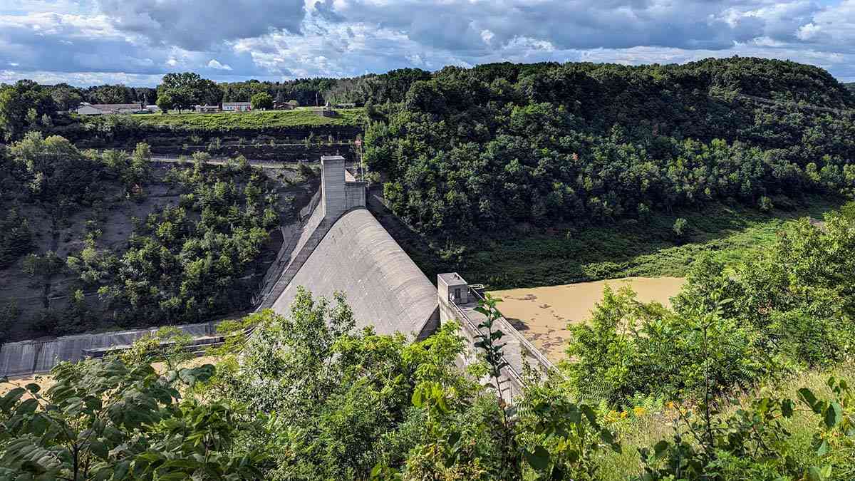
At the northern end of Letchworth State Park, the Genesee River passes through Mount Morris Dam before continuing north toward Rochester and Lake Ontario. The dam is impressive from either side of the river, but each side offers a different experience.
On the east side, the U.S. Army Corps of Engineers operates the William B. Hoyt II Visitor Center and a recreation area, and offers seasonal ranger-guided tours that take visitors onto and inside the dam. On the west side, the Mount Morris Dam Overlook in Letchworth State Park offers a broad view across the gorge.
There is no direct public road across the dam, so plan to visit each side separately.
Start at the Mount Morris Dam Visitor Center

The Mount Morris Dam and Recreation Area is located at 6103 Visitor Center Road in Mount Morris. From the village, follow Route 408 south to the signed entrance on the east side of the Genesee River.
The William B. Hoyt II Visitor Center presents the dam’s history, engineering, flood-control function, and its connection to the Genesee River Valley. Interactive exhibits also explore the work of the U.S. Army Corps of Engineers and the plants and wildlife of the surrounding landscape.
The visitor center is open seasonally, typically from May through October. The outdoor recreation area is open year-round, 6 a.m. to 11 p.m. Because hours and programs may change, check the official website or call 585-658-4790 before making a special trip.
Overlooks outside the visitor center offer views of the dam and the northern end of Letchworth’s gorge. The day-use area also features picnic shelters, grills, playgrounds, trails, and wildlife-viewing opportunities. Admission to the recreation area and visitor center is free.
The visitor center, restrooms, and overlooks are accessible to visitors who use wheelchairs or have limited mobility.

Take a Ranger-Guided Dam Tour

Seasonal ranger-guided walking tours offer a closer look at how this active flood-control structure operates. Visitors descend a steep, paved walkway into the gorge, walk onto the dam’s crest, and then enter the structure.
Inside, an elevator descends about 200 feet into the dam. A narrow concrete passage conveys the dam’s scale in a way the overlooks alone cannot. The interior remains between roughly 40 and 50 degrees year-round, so bring a jacket even on a warm summer day.
The entire route is approximately one mile and includes a sustained climb back up the access walkway. The grade reaches 10 percent, with more than 100 feet of elevation gain, so the tour is not considered accessible to people using wheelchairs or with mobility limitations.
Tour capacity is limited. Review the current schedule and reserve Mount Morris Dam tour tickets on Recreation.gov. Reservations open up to seven days in advance and may be made until 10 a.m. on the day of the tour, subject to availability.
Keep these details in mind:
- Arrive at the visitor center at least 15 minutes before the tour begins.
- Adults must bring a valid photo ID.
- Every participant must complete a liability waiver. A parent or guardian must sign for any child.
- Tours are free, though Recreation.gov charges a nonrefundable $1 reservation fee per ticket.
- Tours may be canceled due to severe weather, flood-control operations, maintenance, or security conditions.
- Only trained service animals are permitted inside the visitor center and during tours.
View the Dam from Letchworth State Park

To view the dam from the west side of the Genesee River, enter Letchworth State Park via the Mount Morris entrance and follow the main Park Road south to the Mount Morris Dam Overlook, which is signed.
The overlook faces across the gorge toward the dam and visitor center. This perspective makes it easier to see how the concrete structure spans the river valley at the park’s northern end. The view can change considerably with the season, river conditions, and flood-control operations.
The area behind Mount Morris Dam does not form a permanent recreational lake. Under normal conditions, the Genesee River flows through outlets near the base of the dam. During periods of heavy rain or snowmelt, the gates can restrict that flow, temporarily holding water in the canyon before releasing it downstream at a controlled rate.
The overlook is a convenient stop when exploring Letchworth’s northern section. Continue south along Park Road to Hogsback Overlook for another view of Highbanks Canyon and the winding Genesee River.
A seasonal vehicle-use fee may be collected at Letchworth State Park. The main Park Road and some facilities may also be affected by winter conditions, so consult the state park website before visiting.
A Brief History of Mount Morris Dam

Communities along the lower Genesee River endured repeated destructive floods in the nineteenth and early twentieth centuries. Between 1865 and 1950, severe flooding occurred roughly once every seven years, affecting farms and villages in the Genesee Valley as well as neighborhoods and businesses in Rochester.
Congress authorized Mount Morris Dam under the Flood Control Act of 1944. Construction began in 1948, and the dam was completed in 1952. The U.S. Army Corps of Engineers continues to operate and maintain the dam.
Standing approximately 250 feet tall and spanning 1,028 feet, Mount Morris is the largest concrete gravity dam east of the Mississippi River. Its weight keeps it in place against the force of the retained floodwater.
The dam protects 67 miles of the Genesee River Valley, from Mount Morris to Rochester. One of its most significant tests came in June 1972, when rainfall from Hurricane Agnes temporarily created a lake that extended about 15 miles into Letchworth’s canyon. Water rose to within five feet of overtopping the dam before being released in a controlled manner.
The dam normally allows the Genesee River to flow through the structure. It holds back water only when conditions warrant, helping reduce downstream flood risk while preserving the river’s usual course through Letchworth.
The exhibits and ranger programs at the visitor center tell this story in greater detail, including how the dam was built, how its gates are operated, and how the structure is monitored today.
Rochester, delivered
A weekly Substack newsletter, with periodic essays exploring behind-the-scenes work and reflections on traveling close to home. While the content is free, paid subscriptions support my ongoing research and writing.
Hiking and Exploring Around the Dam

The east-side recreation area connects to the Letchworth Branch of the Finger Lakes Trail. These paths offer opportunities to walk, run, observe wildlife, and explore a quieter part of the park.
Trail conditions vary, and parts of the gorge are steep. Stay on marked trails and behind barriers, especially near overlooks and the dam. Pets are permitted on a leash in the outdoor recreation area and along trails but are not allowed inside the visitor center or on dam tours unless they are trained service animals.
The Mount Morris Dam area and the adjoining Letchworth State Park are also part of an Important Bird Area. Depending on the season, visitors may spot bald eagles, peregrine falcons, bluebirds, and other birds associated with river and forest habitats.
Plan Your Visit
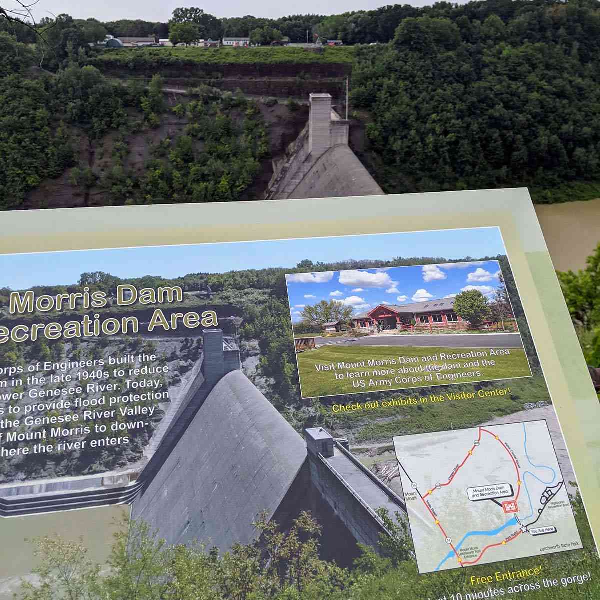
Mount Morris Dam and Recreation Area
6103 Visitor Center Road
Mount Morris, NY 14510
585-658-4790
- Recreation area: Open year-round, 6 a.m.–11 p.m.
- Visitor center and tours: Seasonal, generally May–October
- Admission: Free
- Tour reservations: Recreation.gov
- Official information: U.S. Army Corps of Engineers
Mount Morris Dam Overlook in Letchworth State Park
- Enter through Letchworth State Park’s Mount Morris entrance.
- Follow the main Park Road to the signed overlook.
- Check the official Letchworth State Park website for current hours, fees, maps, and road conditions.
If you have time, consider visiting the dam from both sides of the Genesee River. The east side explains how the structure works, while the west-side overlook shows how it fits into the broader landscape of Letchworth’s Highbanks Canyon.
More Information
- Mount Morris Dam and Recreation Area
- Mount Morris Dam tour reservations
- Letchworth State Park
- The history of flood protection at Mount Morris Dam
Explore More

Explore Letchworth State Park
Letchworth has something for everyone, from hiking one of the park's 29 trails and picnicking beside a waterfall to taking a scenic drive.
Exploring the Genesee Valley
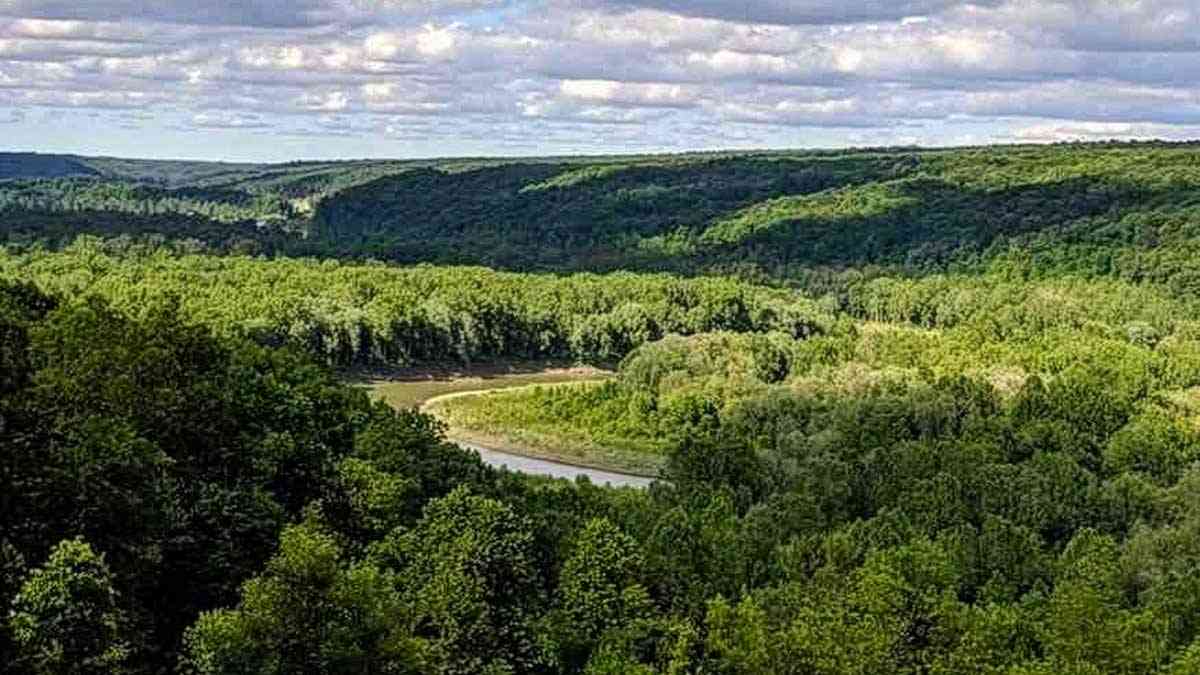
Unhurried day trips through the Genesee Valley—following the Genesee River from Rochester to gorges, villages, trails, and waterfront parks.

Geologic History of the Rochester Area
These day trips into Rochester's geologic history will remind you just how amazing our corner of the Earth is.
Have you explored Mount Morris Dam?
I’d love to hear from you—please reach out and share your thoughts and experiences.


Help Support My Work
If my work has helped you explore and appreciate the Rochester area, please consider subscribing to Substack as a paid member. You’ll receive an email whenever I publish new content and can connect with a growing community of local explorers.
See you out there!
Debi
Enjoy the Journey Together!


