

Established in 1926, Ellison is the first official Monroe County Park. It features five blazed trails of varying difficulty, making it a great spot for outdoor enthusiasts. The park is also a popular spot to launch a kayak or canoe and paddle downstream on Irondequoit Creek toward Irondequoit Bay.
A log blockhouse replica can be found near North Landing Road, marking the presumed site of Fort Schuyler, a 1721 colonial fur trading post. Historical markers provide information about Indian Landing, a portage route used by the Haudenosaunee people to avoid the Genesee River’s waterfalls.

On a hill on the eastern portion of the trail is the presumed site of Peter Schuyler’s 1721 Trading Post, known as “Fort Schuyler.” Its purpose was to encourage trade with the Senecas and compete with the French for furs. The plaque reads,
This log blockhouse was built in 1938 to commemorate the colonial trading post that once stood near this site, The original post is believed to have been built in 1721 by British Capt. Peter Schuyler Jr. and a small company of men to encourage trade with the Indians in the region.
Hiking at Ellison Park
Before heading out, download or print the park map. The park is 447 acres and has five hiking trails of varying difficulty.


Coyote Den Trail
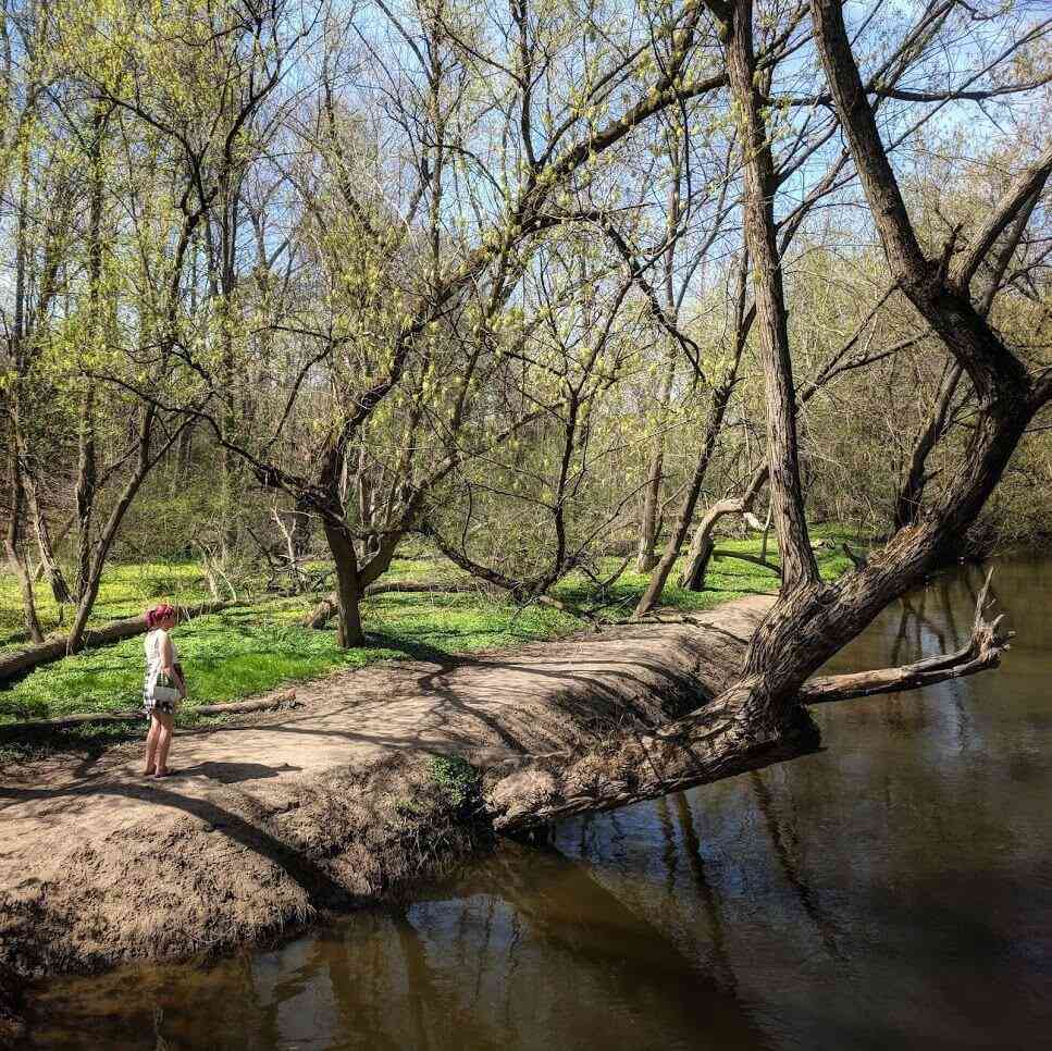
This 1.1-mile trail is easy to moderate and follows a gradual uphill climb to Penfield Road. Near the Blossom Road trailhead, there is a secluded spring pond.
Overlook Trail
This .6-mile walk overlooks Thomas Cove and the stone quarry. This is a moderate to difficult walk, with one very steep section where the trail joins Coyote Den Trail near Irondequoit Creek. You can look uphill here at the steep section to determine how you make the loop, climbing uphill or downhill. On the portion of the trail that follows the Coyote Den Trail, you will be following a creek in a beautiful wooded gully with moss-covered logs, ferns, and wooden bridges.
Mill Race Trail
This .4-mile walk shows the stages between wetlands and a forest. It is an easy walk over level terrine.
Butlers Gap Trail
This .7-mile moderate walk (one way) has many interesting historical features and an intersection that overlooks the wetlands. It is a moderate walk over rolling hills, with one short but steep climb.


Indian Landing Trail
This 1.5-mile easy walk over level terrain is full of history, from the location of an old trading post (Fort Schuyler) to the presumed famous Butlers’ Rangers hideout, marked with commemorative plaques.
A plaque placed on a large boulder along Irondequoit Creek commemorates a nearby location of the “Indian Landing,” which was used for many years by the indigenous Iroquois as the start of the portage route, which led from Lake Ontario, up Irondequoit Creek, and overland to the Genesee River. It reads,
This is the site of Indian Landing, the most important place in the early history of the Genesee Country, all of whose trails led to Irondequoit Bay, a gateway of the Iroquois Confederacy.
Here were scenes of the adventure and romance for a period of more that three hundred years involving Indian wars: the struggle for empire between the French and English: and the Revolutionary and pioneer periods.
Religion, commerce and war made this territory a famous battleground bringing here many noted priests, traders, and soldiers.
Across the creek is the site of Shcuyler’s Fort and the Lost City of Tryon.
More amenities at Ellison Park
Ellison Park has one of the two dog parks in the Monroe County Parks system; the other is at Greece Canal Park.
Ellison is also a prime snow-sport destination, with excellent sledding hills and an outdoor ice skating rink. It has one of two disc golf courses in the county, the other being at Churchville Park.

More information about Ellison Park
Cost: Free
Located in Penfield (get directions)
More information: monroecounty.gov/parks-ellison
If you don’t own a kayak, rent one from BayCreek Paddle Center on Empire Blvd. From their website,
BayCreek Paddling Center offers a canoe/kayak shuttle to the launch site in Ellison Park.
After a short ten-minute ride, the bus arrives at the launch on the park’s southern edge. From there, paddlers will travel downstream for about two miles as the creek twists and turns through the park’s meadows.
You will pass underneath several wooden pedestrian bridges before exiting the parklands and passing under Browncroft Boulevard. You’ll now have about 2.5 more miles to go.
From this point on, the land is in a much more natural state. Shortly after Browncroft, paddlers enter the “Canopy of Trees” and float beneath a ceiling of green. Beyond that, boaters enter the upper marsh, where sightings of beaver, muskrat, deer, and numerous birds are common.
About a mile farther, paddlers arrive at the “Narrows,” where the creek squeezes between the hills of Tryon and Lucien Morin Parks. Paddlers enter the lower marsh and have about 1.5 miles to meander back to BayCreek.
Typical trip time is two to 2.5 hours from when the bus leaves BayCreek.
Explore More
Where is your favorite spot in Ellison Park?
I’d love to hear from you—please share your thoughts and experiences in the comments below.


Help Support My Work
People often ask if I get free access to the places I visit. The answer is no—unless I’m invited to a special preview or offered behind-the-scenes access through my media role. Most of the time, I don’t even mention Day Trips Around Rochester, New York when I visit a place. I want to have the same experience you would.
I create and share this content because it brings me joy—and I hope it adds value to your adventures, too.
If my work has helped you explore and appreciate the Rochester area, please consider becoming a paid subscriber on Substack. You’ll receive an email whenever I publish new content and have the chance to connect with a growing community of local explorers.
Thank you for supporting my efforts to keep producing meaningful and helpful content.
Thank you!
Debi
Enjoy the Journey Together!

Is the sand hill still there?