

Nestled between Culver Road, Monroe Avenue, and Highland Avenue, lower Cobb’s Hill Park is primarily recreational, but the hill makes it unique. A 0.7-mile paved walking path encircles a reservoir and offers a panoramic view of the Rochester skyline. A trail through Washington Grove leads visitors through a tranquil urban forest of old oak trees to a series of ever-changing graffiti-tagged water towers.

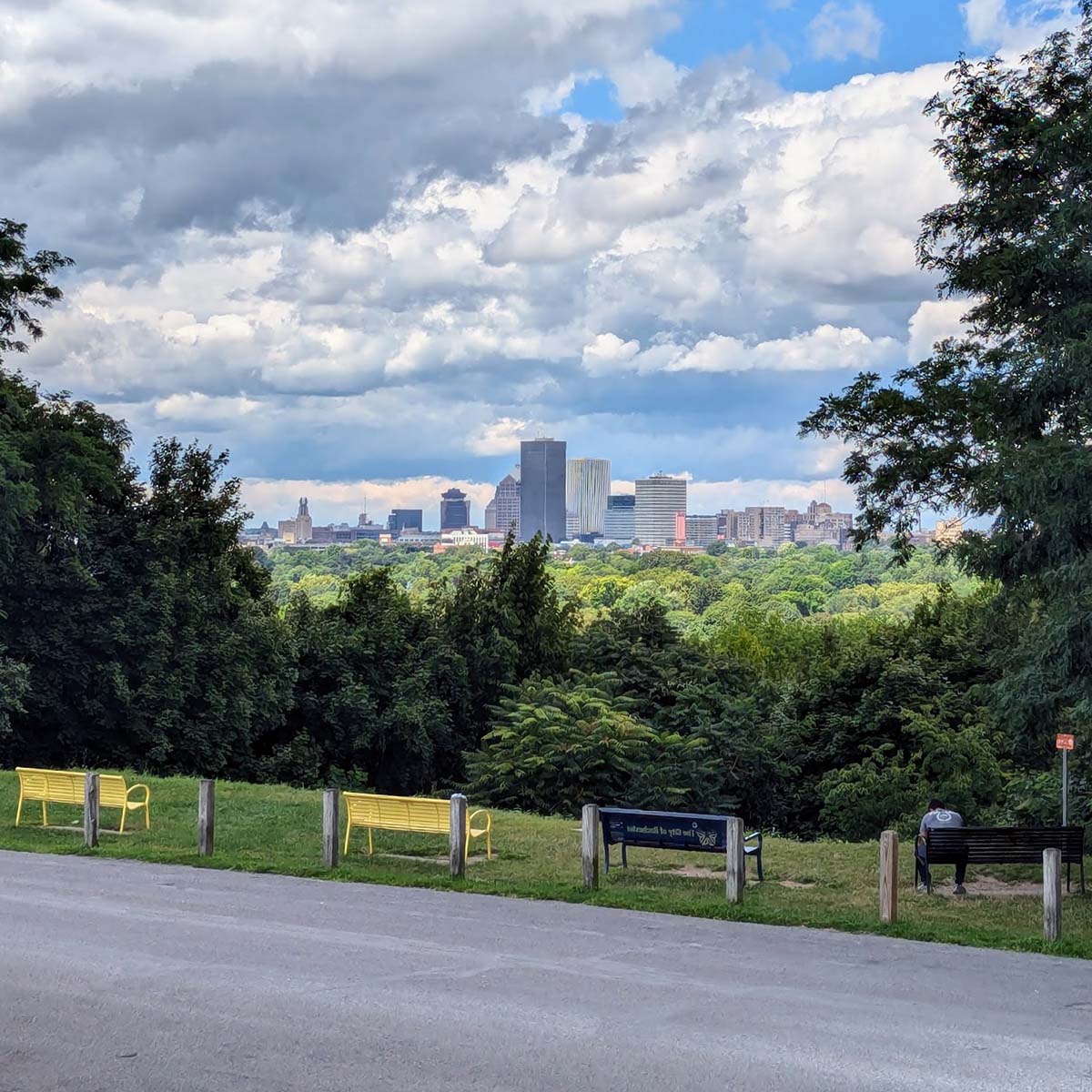
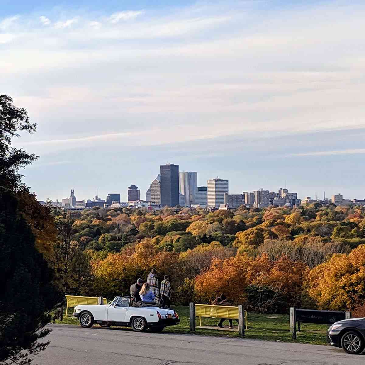
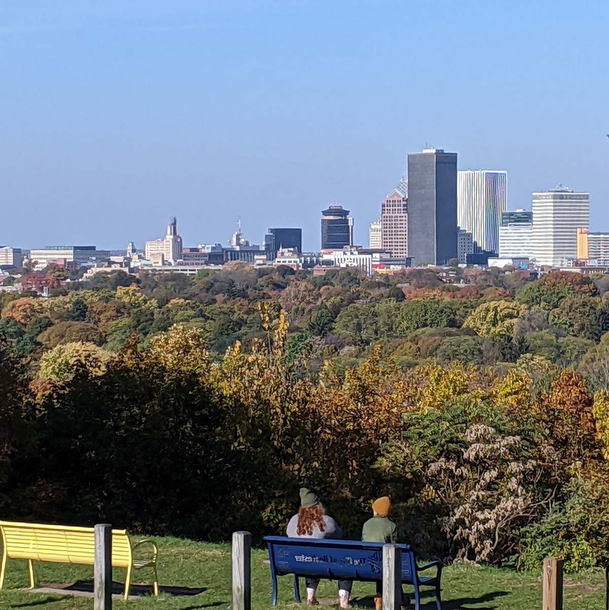
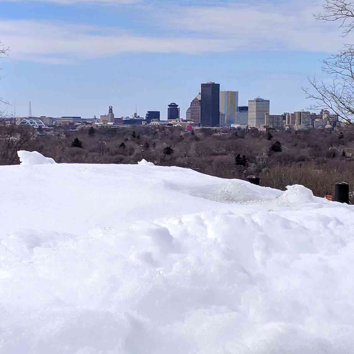


Magnificent Skyline View
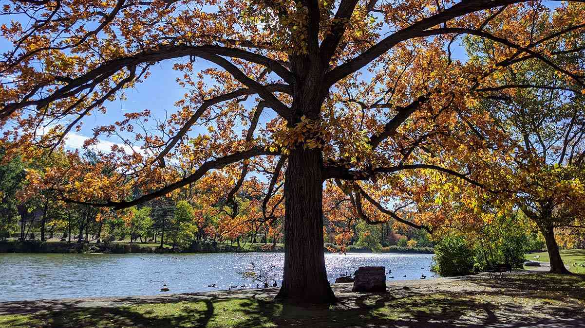
No matter the weather, season, cloud cover, or time of day, I love looking out over the treetops at the Rochester skyline.


Cobb’s Hill Reservoir
The Reservoir’s walkways, iron fence, steps, and overlooks were designed by the Olmsted firm. Encircling the reservoir is a 0.7-mile paved walking path, perfect for a jog or a stroll and a favorite for workday lunch breaks.

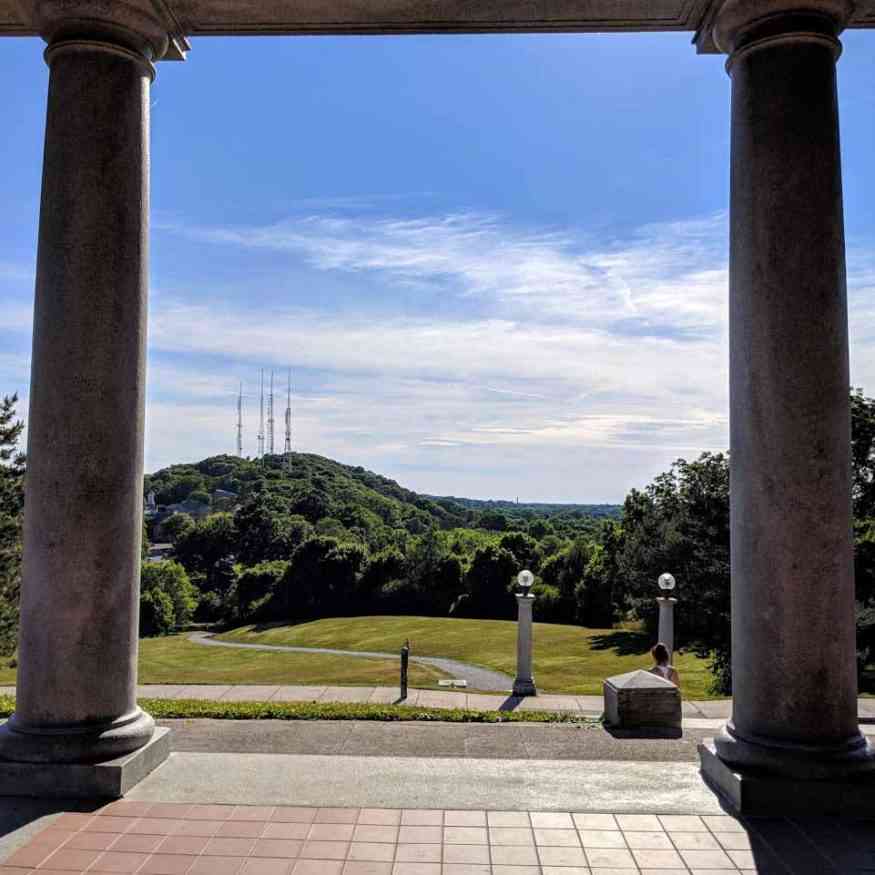
Viewing Pinnacle Hill from Cobbs Hill
Pinnacle Hill is the highest point in Rochester and is home to five of Rochester’s broadcast signal towers. Cobbs Hill and Pinnacle Hill are two of the original five Pinnacle Hills in the Pinnacle Range—a glacial moraine created by the retreating Wisconsin Glacier 10,000 years ago.
Two of the other hills are in Highland and Mount Hope. The fifth was Oak Hill, leveled to create a golf course that has since relocated; the land is now the University of Rochester’s riverside campus.


Cobb’s Hill is the most popular spot to sled in the City of Rochester.

In the right light, the granite, Greek-Revival-style gatehouse reminds me of a Maxfield Parrish painting.

Cobbs Hill also hosts Monroe Country’s Public Safety Communications.

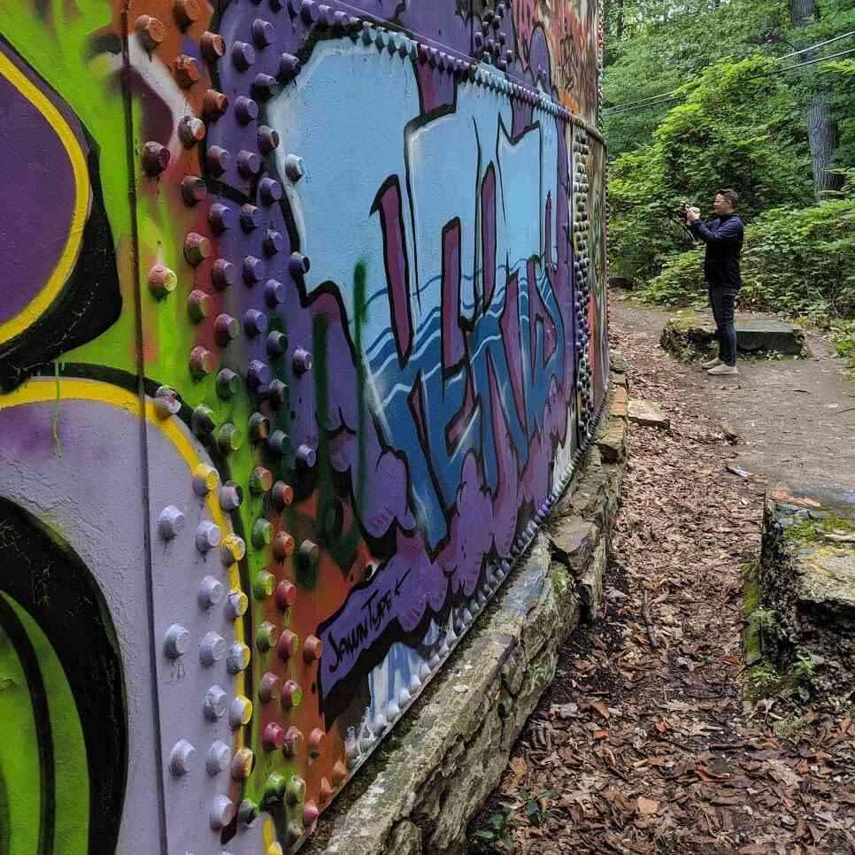
Washington Grove
Because of the Pinnacle Range, all major infrastructure, like the Erie Canal, subway, and expressway, were routed around the area, leaving this beautiful area untouched by development. Early advocates for green space rallied to preserve the woodland.
The water towers in Washington Grove serve as a rotating exhibit for graffiti art. Often, you’ll find artists creating new pieces and practicing their techniques for more significant projects. There are several places to enter the grove, but the most common is on the east side of the reservoir. Look for the trailhead near the northeast part of the tree line. After walking down a steep hill, look to the left to see the water towers behind the trees. Follow the trail east of (or to the right of) the towers to head up the hill. There are also trailheads behind Tay House Lodge on Hillside Avenue and at the dead end of Nunda Boulevard.

(PKA MR. PVRT, aka AEROSOL KINGDOM)


More information about Cobbs Hill Park
Cost: Free
Located in the City of Rochester (get directions)
More information: cityofrochester.gov
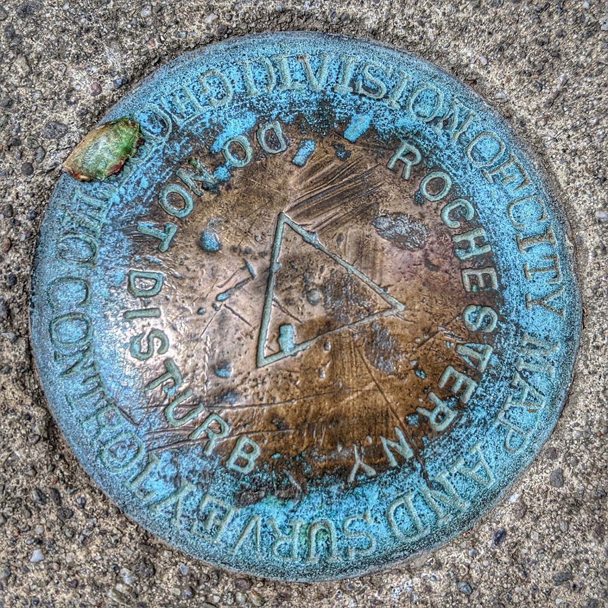
This marker is located on the ground near the overlook.

This marker is located on the ground behind the water tower on the right, coming up the trail. I was unfamiliar with these markers, so I found some information and a few links you may find interesting.
Survey marks are permanent markers with known coordinates on the ground or attached to a structure. Synonyms are “survey points” or “control points.” The term “benchmark” refers to marks indicating elevation, while horizontal position markers used for triangulation are called triangulation stations. Survey markers were frequently placed during triangulation surveys, which were systematic measurements across states or regions to establish angles and distances between different points. Such surveys laid the foundation for map-making worldwide.
Learn more at National Geodetic Survey FAQs, The NGS Data Sheet, and Survey Marker on Wikipedia.
Explore More

50 Hidden Places Around Rochester
From secret gardens to enchanting waterfalls, exploring hidden places around the Rochester area is the ultimate way to add some spice to your travel experiences.

132 Things to Do Around Rochester, NY
We've pulled together a list of fun and unique things to do around Rochester, NY, within two hours of home—perfect for quick getaways.

Parks and Preserves Around Rochester
Enjoy the beauty and wonders of the world by making the most of the varied memorable experiences offered by our parks, gardens, and farms.

80+ Hiking Trails Around Rochester: A Trail for Every Season
Explore 80+ hiking trails around Rochester, and learn how to choose the right trail for every season—from spring waterfalls to winter woodlands.
22 Monroe County Parks
Monroe County parks are free and offer 12,000 acres of natural, zoological, horticultural, historical, and geological experiences.
When is your favorite time to visit Cobb’s Hill?
I’d love to hear from you—please share your thoughts and experiences in the comments below.


Help Support My Work
People often ask if I get free access to the places I visit. The answer is no—unless I’m invited to a special preview or offered behind-the-scenes access through my media role. Most of the time, I don’t even mention Day Trips Around Rochester, New York when I visit a place. I want to have the same experience you would.
I create and share this content because it brings me joy—and I hope it adds value to your adventures, too.
If my work has helped you explore and appreciate the Rochester area, please consider becoming a paid subscriber on Substack. You’ll receive an email whenever I publish new content and have the chance to connect with a growing community of local explorers.
Thank you for supporting my efforts to keep producing meaningful and helpful content.
Thank you!
Debi
Enjoy the Journey Together!
